Esri ArcGIS

ArcGIS Pro is a full-featured professional desktop GIS application from Esri.
Platform
Windows
With ArcGIS Pro, you can explore, visualize, and analyze data; create 2D maps and 3D scenes; and share your work to ArcGIS Online.
UC San Diego students, faculty, and staff can create and share interactive maps and web applications using spatial data.
ArcGIS Online runs on any device with an internet connection. To access all licensed products you must have an organization account.
Get Access
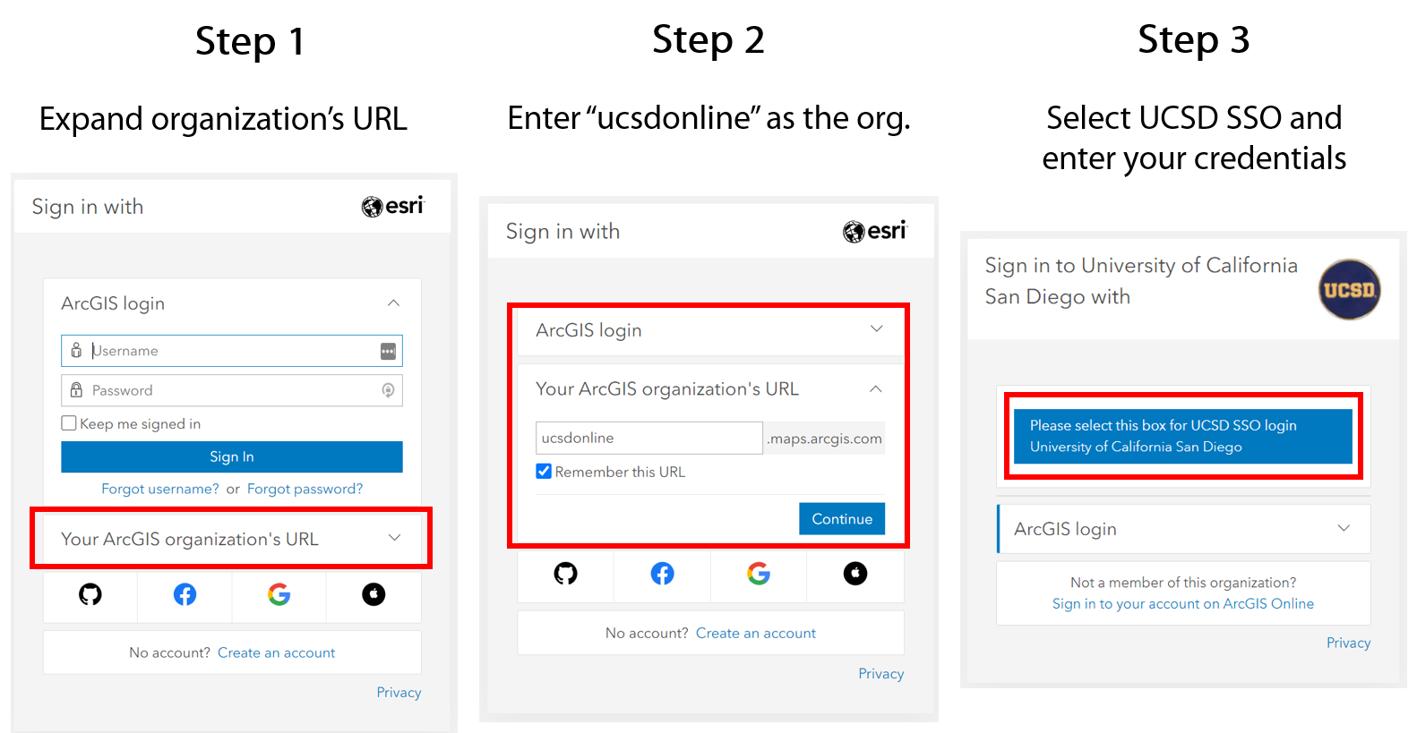
Please visit ucsdonline.maps.arcgis.com and sign in using your Active Directory (AD) credentials.

ArcGIS Pro download
If you need to access a copy of an older release of ArcGIS Pro, including the version currently installed in our computer labs, please check OneDrive folder. Please log in using your Active Directory (AD) credentials to access the ArcGIS Pro OneDrive folder.
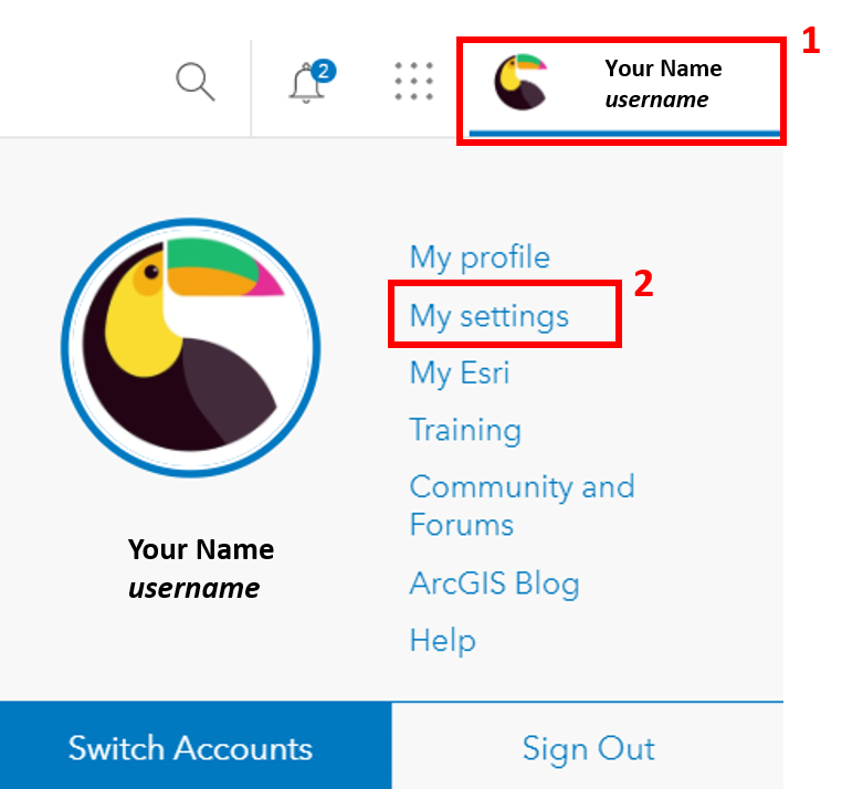
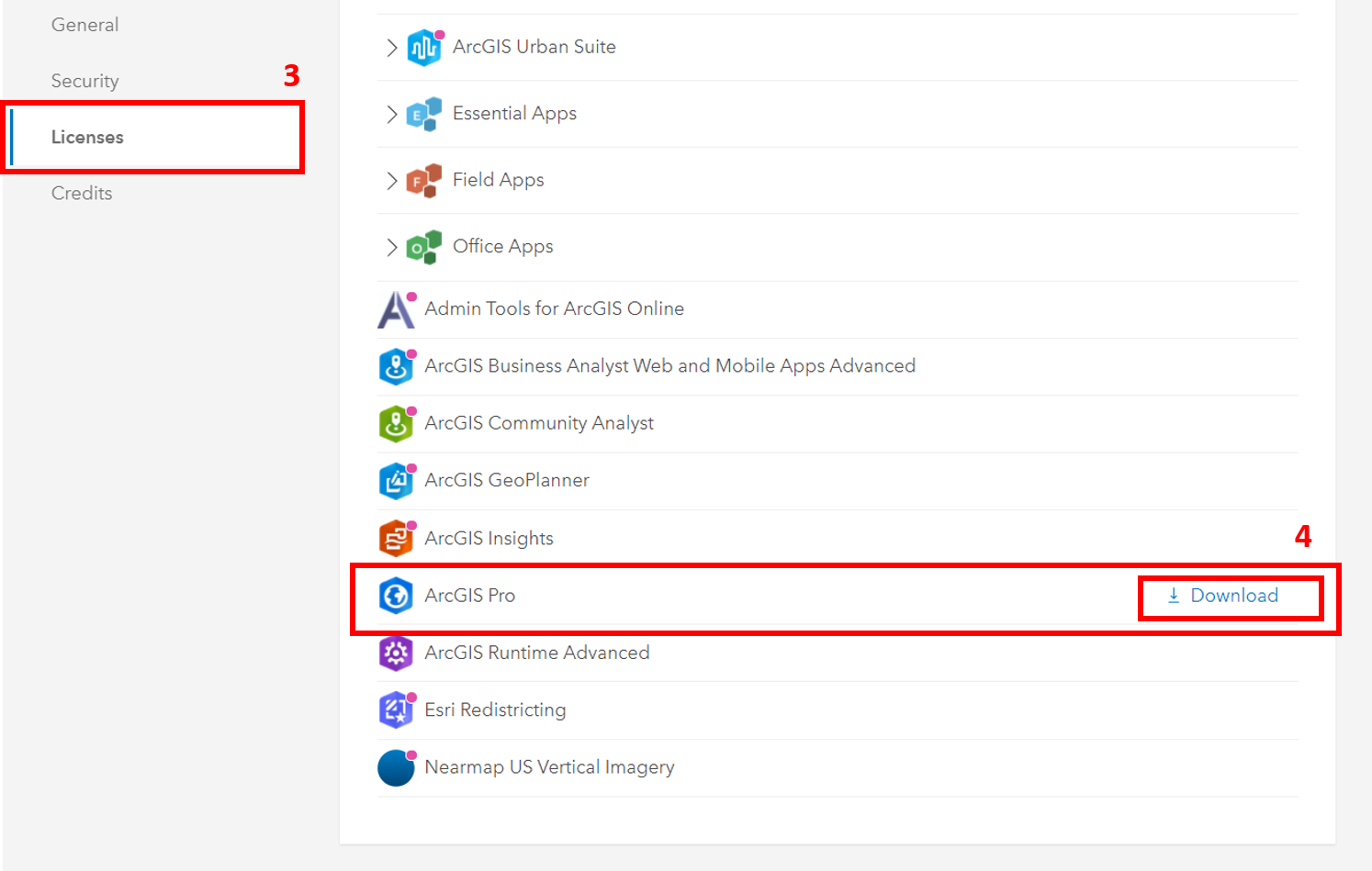
The latest ArcGIS Pro software download release is available on the ArcGIS Online (AGO) site under My Settings -> Licenses.

Additional Resources:
Esri Academyoffers training and certification for individuals to learn, grow and validate their skills. Members of an ArcGIS Online organization qualify for unlimited e-Learning access.
The Data & GIS Lab in Geisel Library is a place to get specialized, hands-on assistance with data and GIS software.
The GIS & Geospatial Technologies guide from the Library provides GIS tutorials, data, books, course-specific GIS guides, and other geospatial-related information that might be of interest.
The UC GIS Hub is your community to connect with colleagues across the UC and to talk, share, and learn about geospatial technology and its applications. The UC GIS Hub is the home to resources on geospatial software, data, training, and more.
