Camp Matthews: Maps of the Formerly Used Defense Site at UC San Diego
Last Updated: July 28, 2022 11:05:21 AM PDT
Give feedback
See maps of the Camp Matthews Formerly Used Defense Site area at UC San Diego.
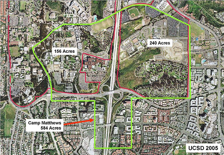
Images below show (1) Camp Matthews boundaries in 1953 and (2) an overlay of the Formerly Used Defense Site (FUDS) area on a 2005 aerial map of UC San Diego.
- Read more about the Camp Matthews FUDS area on campus, and what to do if you encounter or suspect the presence of unexploded military ordnance or debris.
Image 1: Aerial view of Camp Calvin B. Matthews*, 1953, with current UC San Diego landmarks indicated for reference.
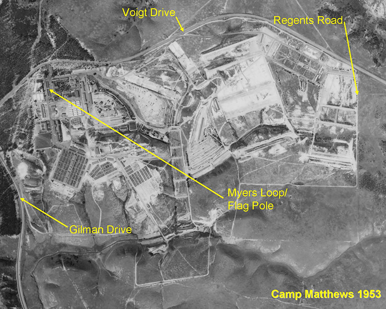
Image 2: Camp Matthews FUDS area, approximately 400 acres, overlaid on an aerial map of UC San Diego in 2005.*
* Information provided by the U.S. Army Corps of Engineers Site Inspection Report of former Camp Calvin B. Matthews Site and UC San Diego image files.
For more information, contact Environmental Affairs, (858) 246-5111 or (858) 534-3660.